Found 3 results
Article
18 December 2023Measurement of Energy Poverty and Influencing Factors of Rural Households in China
Despite being the world’s largest developing country, China faces significant disparities between urban and rural areas, which exacerbates energy poverty in rural regions. This issue of energy poverty is a global concern, as millions of people lack access to modern energy necessary for a decent quality of life. This research aims to analyze the levels and structures of energy consumption in rural Chinese households, using data from the Chinese General Social Survey (CGSS) conducted in 2015 and 2018. The research employs the poverty line threshold and Theil index methods to comprehensively assess energy poverty in diverse regions. It also examines the economic, social, and familial factors influencing rural energy poverty. The findings reveal a transition in rural energy consumption towards cleaner sources, but energy poverty remains a significant issue. Factors such as energy prices and household size have a positive impact on energy poverty, while per capita income, education level, and social factors exert a negative influence.

Article
14 June 2023Spatio-temporal Evolution and Influencing Factors of Farmland Circulation Price at the County Level in China
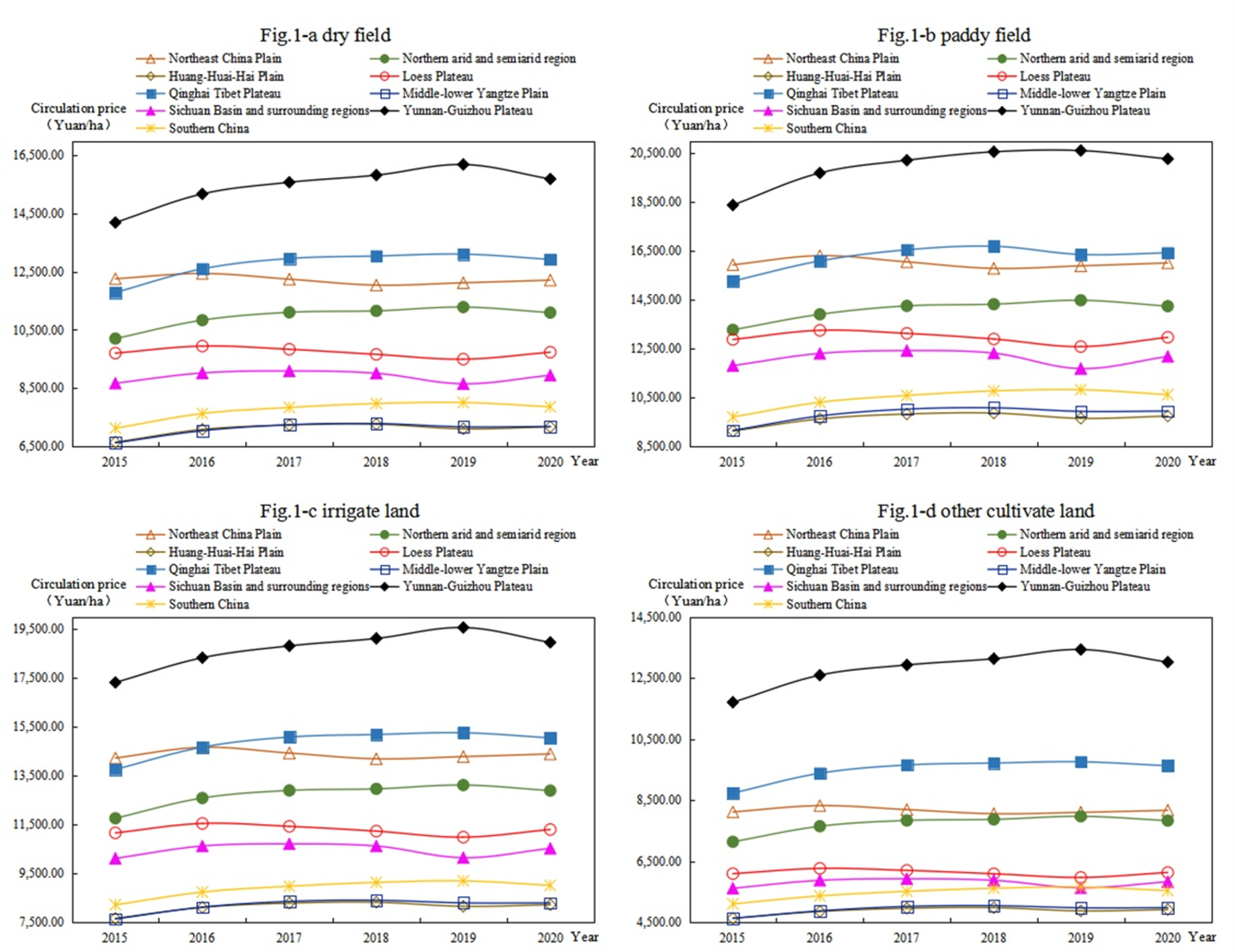
Farmland circulation is an important way to achieve moderate scale operation to ensure food security. Based on the spatial analysis and spatial econometric model, this paper studies the spatial-temporal evolution and influencing factors of cultivated land transfer price at the county level in China from 2015 to 2020. The results revealed the following: (1) the circulation price of farmland generally shows paddy field > irrigated land > dry land > other cultivated land. The farmland circulation price in Huang-Huai-Hai Plain is always the highest, whereas that in Qinghai–Tibet Plateau is always the lowest. (2) The spatial pattern of farmland circulation price is high in the south and low in the north, presenting an inverted U-shaped structure from east to west in 2015, and high in the east and low in the west, presenting an inverted U-shaped structure from north to south in 2020. Moreover, the spatial agglomeration was enhanced. (3) With the development of land market and urbanization, the restriction of natural factors of cultivated land on the farmland circulation price weakens, while the socio-economic attribute of cultivated land constantly strengthens. Based on the results, this paper puts forward some suggestions to prevent the overcapitalization of land.

Article
03 March 2023Spatial Characteristics and Influencing Factors of Migration in Kanagawa, Japan
In the context of “Tokyo centralization”, population migration has become an important factor affecting Kanagawa's economic growth, living standards, and employment status. On the other hand, with the development of the declining birth rate and aging society, migration for any purpose has an impact on social development. The government has released many policies to attract people from other cities to Kanagawa. This study analyzes the factors influencing the spatial pattern of population migration in Kanagawa based on the current spatial characteristics of population migration in Kanagawa from 2016~2020 and previous population migra-tion research theories. the influencing factors are analyzed empirically by selecting a total of 9 economic, social, and environmental indicators that may affect the spatial pattern of population migration in Kanagawa. The result showed that, when only the economic factor was considered, gross prefectural product, job opportunities, and consumer price index significantly influenced migration; When only environmental factors are considered, the number of pollution complaints successfully handled had a significant positive effect on population migration; When only the social environment is considered, the level of education becomes the main consid-eration for people. Furthermore, when the economic factors, environmental factors, and social factors are analyzed together, the gross prefectural domestic product, job opportunities, consumer price index, and the number of pollution complaints successfully handled all have an impact on migration in Kanagawa and the gross prefectural product is the common influencing factor.
